LEXINGTON, Ky. (WKYT) — After a record-cold start to September, temperatures are surging back into summer-like territory across Kentucky.
Weekend Outlook
This Article Includes
-
Friday: Highs reached 90° in western Kentucky, with low-to-mid 80s across central and eastern regions.
-
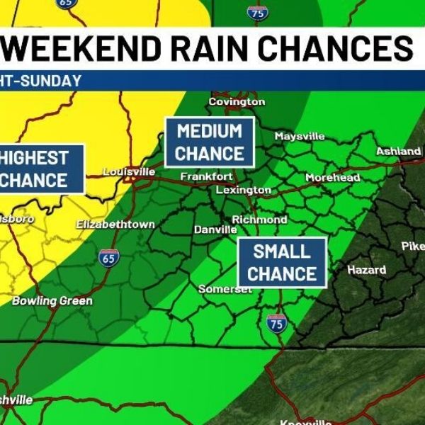
Saturday–Sunday: Expect similar warmth, with readings rising a degree or two. Skies will stay partly cloudy, but the chance of showers and thunderstorms grows Saturday night into Sunday. Storms may move north to south, and could even loop back toward the southwest.

Early Next Week
-
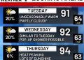
Monday–Tuesday: Temps stay hot, 85–90°, under mostly dry skies.
-
Wednesday–Thursday: Storm chances return as a cold front approaches, setting the stage for cooler air and more rain by late week.
Looking Ahead
The cold front may deliver the best of both worlds—relief from the heat along with needed rainfall heading into next weekend.
This article has been carefully fact-checked by our editorial team to ensure accuracy and eliminate any misleading information. We are committed to maintaining the highest standards of integrity in our content.


