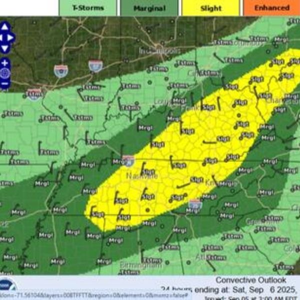
A strong cold front moving in on Friday, September 5, is expected to bring severe thunderstorms and an isolated tornado risk across Tennessee, Kentucky, West Virginia, and Southeast Ohio, according to the Storm Prediction Center.
Cities in the risk zone include:


-
Nashville, TN
-
Murfreesboro, TN
-
Lexington-Fayette, KY
-
Bowling Green, KY
-
Charleston, WV
While the primary threat comes from damaging wind gusts, forecasters warn there’s also a chance of one or two isolated tornadoes.
The severe weather risk stems from a powerful cold front moving southeast from the Northern Plains and Great Lakes, bringing a much cooler air mass from Central Canada.
Timing & Impact
-
Main risk period: Friday afternoon and evening
-
Development zone: Western Tennessee and Western Kentucky
-
Storm path: Thunderstorms will intensify as they move east into Central and Southern Appalachians overnight into Saturday morning.
After the front passes, the region will experience a cooler stretch of below-average temperatures, lasting through mid-next week.
Officials urge residents to monitor updates from the Storm Prediction Center and local National Weather Service offices for real-time alerts and safety instructions.
This article has been carefully fact-checked by our editorial team to ensure accuracy and eliminate any misleading information. We are committed to maintaining the highest standards of integrity in our content.


