Good Wednesday, everyone! Crisp mornings continue, but afternoons are gradually warming up. With the temperature climb comes a slight chance for a shower or storm tonight and Thursday, with better rain chances showing up late this weekend into early next week.
🌡️ Today’s highs:
Related posts

-
East: mid to upper 70s
-
West: 80–85°
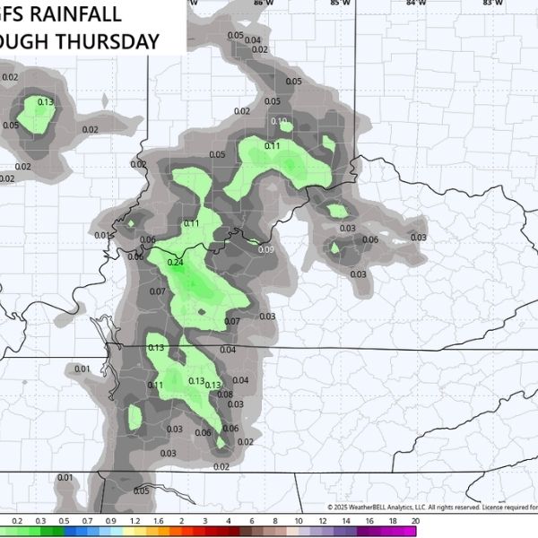
A weak system sliding in from the northwest may bring just enough energy to spark a stray shower or storm tonight into Thursday.
-
GFS model: favors central and western Kentucky
-
EURO model: leans toward central and southern Kentucky
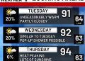
🌤️ Friday into the weekend: Temps rise into the 80s with a mix of sun and clouds — a more typical late-summer setup.
⛈️ Late Sunday into early next week: A better chance of showers and storms develops, though models differ on timing and coverage.
📉 Mid-month outlook: EURO ensembles suggest a blocky pattern could dip the jet stream across the eastern U.S. around mid-September, possibly cooling things down again.
📆 30-day trend: EURO weeklies continue to show strong Canadian blocking. That pattern usually favors downstream troughing in the eastern half of the country. Overall, the setup looks drier than normal — unless the tropics shake things up.
Have a wonderful Wednesday! 🌞
This article has been carefully fact-checked by our editorial team to ensure accuracy and eliminate any misleading information. We are committed to maintaining the highest standards of integrity in our content.


