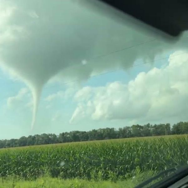
Sioux Falls, S.D. – Spotters in northwest Iowa reported funnel clouds Sunday evening as scattered showers moved across the region. Although these funnels are usually weak and short-lived, residents in southeastern South Dakota, northwest Iowa, and southwest Minnesota are urged to stay alert until nightfall.
The National Weather Service in Sioux Falls and Des Moines stated that atmospheric conditions remain favorable for brief funnel cloud formation through 8 p.m. Sunday. These funnels typically extend only a few hundred feet from the cloud base and rarely touch down, but residents should head indoors if they feel threatened.
Related posts

Reports of funnel clouds have already emerged in Lyon, Osceola, and Dickinson counties in Iowa, with possible additional activity across Plymouth, Woodbury, and Cherokee counties, including Sioux City and Storm Lake. Communities such as Huron, Mitchell, and Sioux Falls in South Dakota, along with Worthington, Minnesota, remain under watch as evening showers continue.
While forecasters don’t expect significant damage, they recommend seeking shelter if a funnel cloud appears overhead. The National Weather Service urges residents to report any sightings and warns that a tornado advisory could be issued if conditions worsen.
This article has been carefully fact-checked by our editorial team to ensure accuracy and eliminate any misleading information. We are committed to maintaining the highest standards of integrity in our content.


